


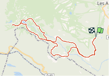


13.3 km | 19.3 km-effort


User


FREE GPS app for hiking
 SityTrail
IGN / Geographical institutes
SityTrail World
The world is yours!
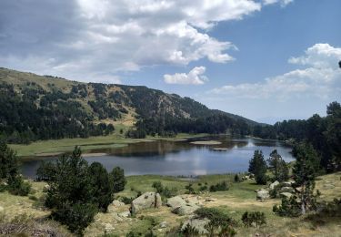
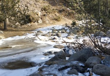
Trail Snowshoes of 14.5 km to be discovered at Occitania, Pyrénées-Orientales, Les Angles. This trail is proposed by xav34830.

Walking

Snowshoes
Walking

Walking

Walking

Walking

Nordic walking
Walking
Walking